Bergen Hiking
Bergen, in Vestland county on Norway's southwestern coast, is one of the few European cities where a genuine mountain trail starts at the end of a city bus line, and this guide covers the climbs, the transport and the weather numbers that matter.
Short answer
The most popular hike in Bergen is the Stoltzekleiven stone stair climb from Sandviken up to the Fløyen plateau: free to walk, starting inside the city. Fløyen and Ulriken carry the wider trail networks, a Skyss single is 51 NOK, and a 24-hour Bergen Card at 400 NOK covers buses and the light rail.
Bergen, in Vestland county on Norway's southwestern coast, is one of the few European cities where a genuine mountain hike starts at the end of a city bus line. The city sits wedged between the sea and a ring of mountains, and the trailheads are so close to the residential streets that locals treat an evening climb the way other cities treat a walk to the shop. This guide, written by the editorial desk behind Bergen Travel Guide, covers the climbs people actually ask about, the transport that reaches them, and the weather numbers that decide what you should wear. Nobody on this desk has been to Bergen; every figure below comes from a primary source, from the official 2026 Bergen Card flyer to the Met Norway climate table for the city.
What Is The Most Popular Hike In Bergen?
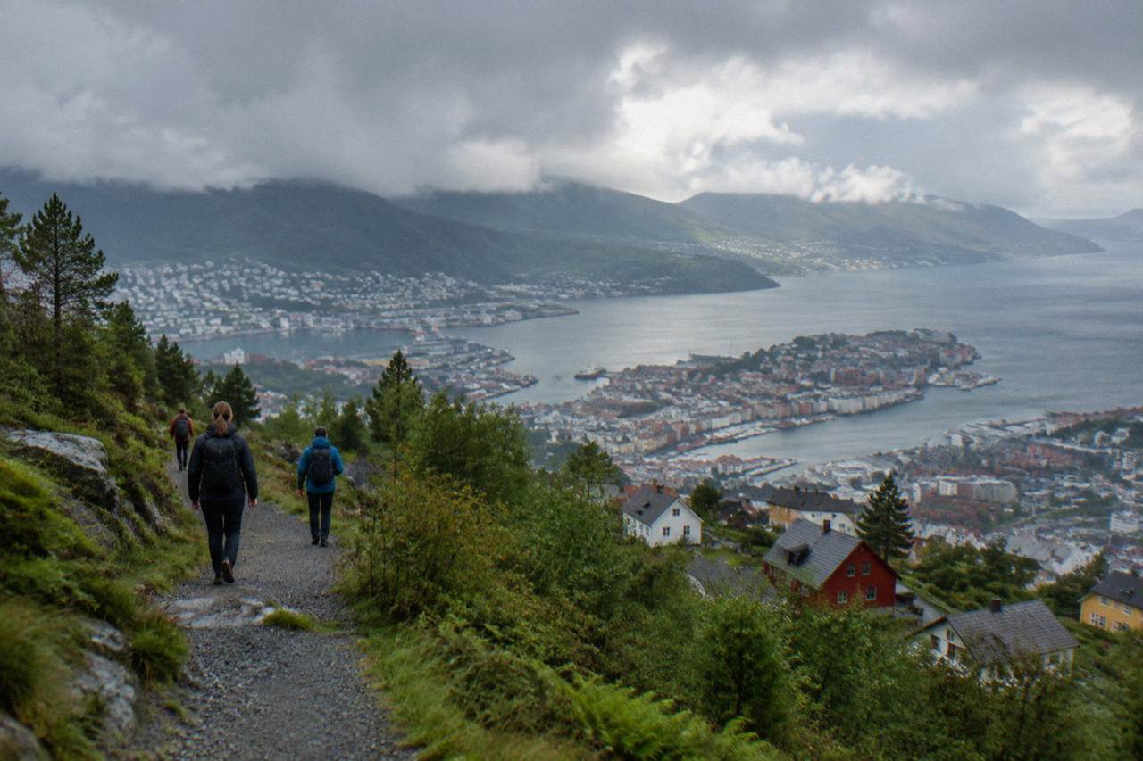
The Stoltzekleiven stair climb, the stone steps rising from the Sandviken district on Bergen's northern edge up to the Fløyen plateau, is the hike most people mean when they ask this question: it is free to walk, it starts inside the city, and it finishes on the mountain every visitor already knows. Ask at the tourist office, a hostel noticeboard or a local, and this stair climb is the answer that keeps coming back.
Ask a different version of the question, "which Bergen hike do the guidebooks picture," and the answer shifts to Fløyen, the forested plateau above the city that the funicular serves. But popularity by footfall belongs to the stairs. Stoltzekleiven is a stairway first and a trail second: stone steps cut into the flank of the mountain, climbing steeply from the old wooden-house streets of Sandviken to the top station area of Fløyen. You do not need a car, a tour or a map with contour lines to do it. You need legs and rain-aware shoes.
The character of the climb matters more than any list. It is steep for the whole way up, with steps that do not flatten out into consolations, and the reward at the top is the plateau's network of easy forest paths, lakes and viewpoints, which you can wander for an hour before descending. Many walkers take the funicular down rather than repeating the stairs on tired knees; the funicular's own return pricing is covered further down this page, in the trailhead transport table.
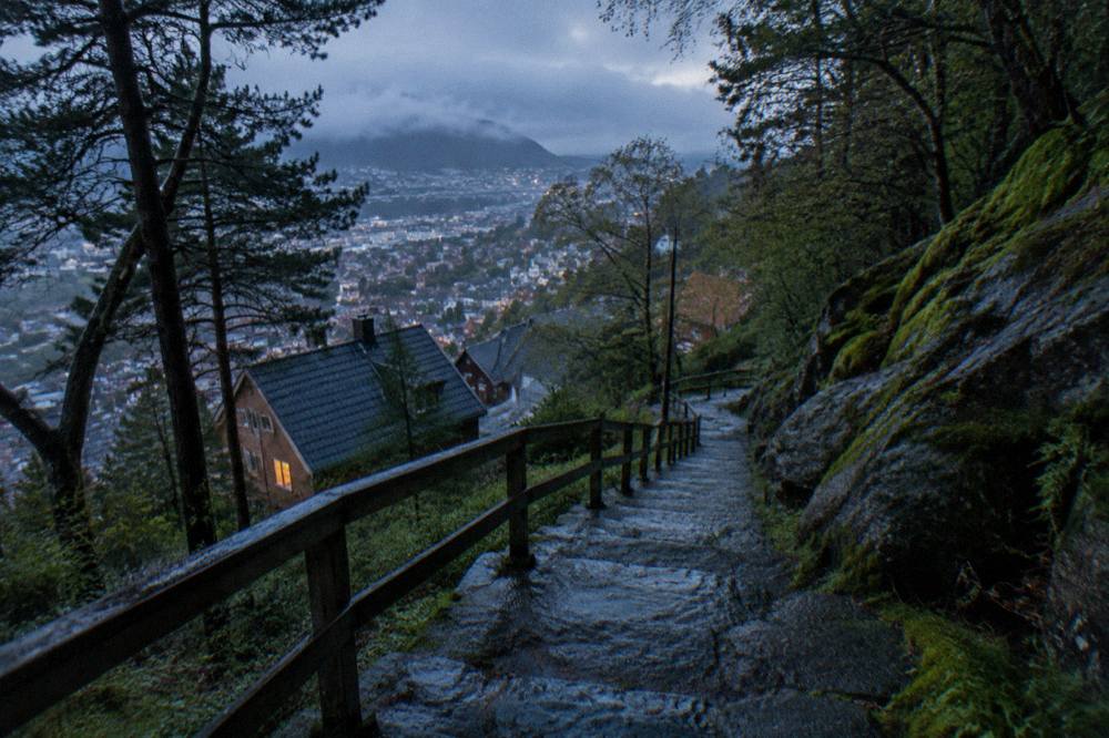
One practical note that first-time visitors miss: the stairs are one-way traffic in practice. Walkers coming down the same steps and walkers going up share a narrow stone stair, so in busy summer hours the descent is better made via the plateau paths or the funicular. If you are planning a first trip to the city, the planning a trip to Bergen guide puts the climb in the context of everything else you will want to book.
What Can You Hike On Fløyen And Ulriken?
Fløyen and Ulriken are the two anchor mountains of Bergen hiking: Fløyen, reached by the funicular from the city centre, offers a broad plateau of easy gravel and forest trails suited to families and runners, while Ulriken, the highest of the mountains around the city, carries wilder, rockier ground served by the Ulriken643 cable car, and together they frame almost every walk a visitor will take.
Fløyen is the gentle giant. The top station opens onto a plateau where paths split in every direction: short viewpoint loops near the edge, longer forest routes heading away from the city, and playground and picnic infrastructure that make it the default family outing. Because the funicular climbs from a station a few minutes from the Fish Market, Fløyen is also the answer for anyone who wants mountain views without a mountain effort. You can ride up, walk a flat loop, and be back at sea level inside two relaxed hours.
Ulriken is the serious sibling. The ground is higher, the weather feels closer, and the trails connecting Ulriken's summit area toward Fløyen's plateau form the classic long link-walk between the two mountains that locals treat as a rite of passage. The Ulriken643 cable car gives a non-hiking way to the top for anyone who wants the view without the climb, and its prices and 2026 maintenance dates are set out later in this guide. For sizing the walk against everything else a Bergen visit can hold, the best time to visit Bergen guide is the companion page.
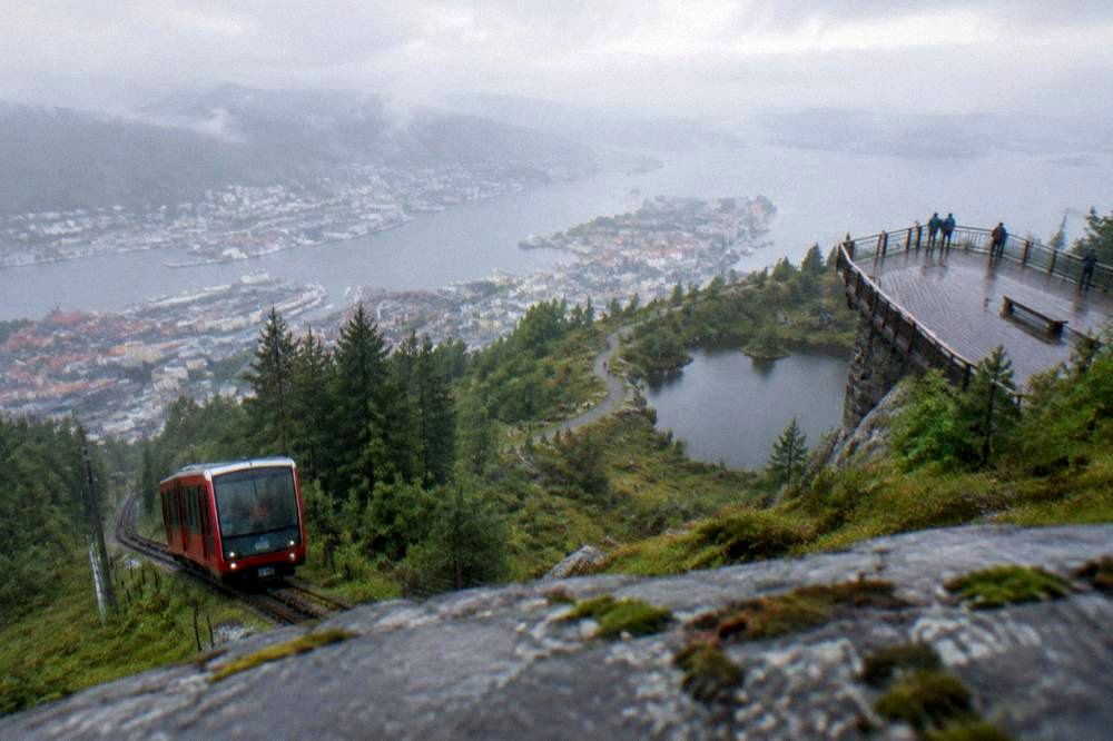
The two mountains also split the city's hiking identity neatly. Fløyen is where Bergen goes with children and visiting parents. Ulriken is where Bergen goes to be alone above the clouds. Choose based on what you want from the top, not from the bottom.
How Do You Get To The Trailheads In Bergen?
Reaching Bergen's trailheads is a public-transport problem with cheap answers: a single Skyss bus or light-rail ticket in zone A costs 51 NOK, the Bergen Card covers Skyss buses and the Bybanen light rail across Vestland county including the airport line at no extra charge, and the Fløyen funicular departs on foot from the city centre, so no hike here requires a car.
The practical pattern for Stoltzekleiven is a short bus hop to the Sandviken side of the city and a walk to the bottom of the stairs. For Ulriken, the trailhead sits beyond the western edge of the centre, and walkers typically reach it by bus or by combining the light rail with a walk. The full transport picture, including the airport line and the bus zone rules, is laid out in the getting around Bergen guide, and the price columns below are drawn from the visitbergen.com transport page and the 2026 Bergen Card flyer.
| Option for reaching the mountains | Adult price | Child / notes |
|---|---|---|
| Skyss bus or Bybanen single, zone A | 51 NOK | Per the visitbergen.com Skyss page |
| Bergen Card 24h (all Skyss buses + Bybanen, Vestland county) | 400 NOK | Child 100 NOK, per the 2026 flyer |
| Fløyen funicular return, 1 Apr - 30 Sep | 200 NOK | Child 100 NOK, per the flyer price table |
| Fløyen funicular return, 1 Oct - 31 Mar | 145 NOK | Child 75 NOK, per the flyer price table |
| Ulriken643 cable car return | 435 NOK | Confirmed on ulriken643.no/en/prices |
A note on the Bybanen worth knowing before you plan: in summer 2026, scheduled maintenance suspended Line 1 between Slettebakken and Byparken from 29 June to 26 July 2026, with replacement buses running and the airport-to-Slettebakken segment operating normally, and the Nonneseter stop has been closed in the city-bound direction since 23 February 2026. None of this touches the mountain trailheads directly, but it shapes how you cross the centre to reach them, so check the Skyss travel planner for the day you walk.
If the mountain stair climb is booked for the afternoon, the flat city makes a good morning warm-up, and a guided Walking Tour of Central Bergen covers the historic core before you spend your legs on the steps. Check availability if that split day appeals.
The stairs will still be there when the walking tour ends, and they are open all day, so the order you do them in is genuinely a matter of preference.
What Does A Bergen Card Cost, And Does It Cover Hiking Transport?
A 24-hour Bergen Card costs 400 NOK for an adult and 100 NOK for a child aged 3-15, with 48h at 500/125, 72h at 600/150 and 96h at 700/175 NOK, and per the official 2026 flyer it includes free Skyss buses and the Bybanen light rail across Vestland county including the airport line, plus a discounted Fløyen funicular ticket purchasable at the ticket office.
For a hiker, the card is essentially a transport pass with museum entries attached. Every bus ride to a trailhead is covered, the light rail is covered, and the discounted Fløyen rate means you can climb one mountain under your own power and descend the other by funicular without paying two full walk-up prices. The full line-item detail, including what the card does at museums and the aquarium, is in the Bergen Card guide.
| Bergen Card 2026 | Adult | Child (3-15) |
|---|---|---|
| 24 hours | 400 NOK | 100 NOK |
| 48 hours | 500 NOK | 125 NOK |
| 72 hours | 600 NOK | 150 NOK |
| 96 hours | 700 NOK | 175 NOK |
Source for every figure in that table: the official Bergen Card flyer published 12 May 2026 on visitbergen.com, the same flyer that prices the funicular and the Ulriken643 cable car. One limit to note honestly: the flyer shows the card's discounted Ulriken arrangement rather than a standalone mountain-ticket comparison, so if you plan to ride both lifts on the same day, do the arithmetic from the card's own line items rather than from a rounded rule of thumb.
For a two-day itinerary built around walking, the card at 500 NOK is usually the fit, because most hiking itineraries compress into a first full day on Fløyen and Stoltzekleiven and a second day further afield. The one day in Bergen and two days in Bergen pages show how walkers slot the trails between the harbour and the museums.
When Is The Best Season For Hiking In Bergen?
By the Met Norway numbers for Bergen, July is the warmest hiking month with an observed mean of 14.9C and June follows at 14.4C, while April was the driest recent month in the observed table at 65.9mm of rain against a 141.0mm normal, so the honest answer splits in two: summer for warmth and long evening light, the April-to-May shoulder for the driest ground underfoot.
The climate table below is the yr.no Bergen station data, the Norwegian Meteorological Institute's own numbers, and it is worth reading row by row rather than trusting a single "Bergen is rainy" line. The trailing thirteen months show monthly precipitation totals swinging from 82.0mm in January 2026, an unusually dry month against its 256.0mm normal, to 321.8mm in November, wetter even than its own 275.0mm normal. Hiking here means hiking in a wet climate; it does not mean hiking in a hopeless one.
| Month | Mean temperature (observed) | Precipitation (observed) | Precipitation normal |
|---|---|---|---|
| September | 13.1C | 206.6 mm | 248.0 mm |
| October | 9.7C | 231.9 mm | 268.0 mm |
| November | 6.0C | 321.8 mm | 275.0 mm |
| December | 5.8C | 303.5 mm | 290.0 mm |
| January | -1.4C | 82.0 mm | 256.0 mm |
| February | 0.8C | 133.4 mm | 209.0 mm |
| March | 5.9C | 243.9 mm | 202.0 mm |
| April | 7.9C | 65.9 mm | 141.0 mm |
| May | 9.9C | 127.4 mm | 109.0 mm |
| June | 14.4C | 165.7 mm | 132.0 mm |
| July | 14.9C | 184.2 mm | 158.0 mm |
| August | 14.3C | 243.6 mm | 208.0 mm |
Two seasons deserve special comment. Winter hiking is real in Bergen, with the funicular running year-round and the mountain plateaus holding snow and ice rather than closing, and the Bergen in winter guide covers what that looks like in practice; note that the plateau in January 2026 averaged -1.4C at the city station, and the mountains run colder than the harbour. Summer is the busy season, and the Bergen in summer page explains how the festival calendar fills the base of the mountains even while the trails above stay quiet.
Can You Hike Mount Ulriken, Bergen's Highest Mountain?
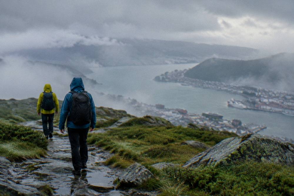
Yes, Ulriken is hikeable on marked trails from the city's western edge, and the Ulriken643 cable car offers a return ride priced at 435 NOK per adult, confirmed on ulriken643.no's own price page, with scheduled maintenance closing the cable car in the first two weeks of 2026 and a reopening around 13 January, so mid-winter visitors should plan the climb as a stairs-and-boots affair.
The walk up Ulriken is a different proposition from Stoltzekleiven. Where the stairs are a single committed line, Ulriken's network spreads: shorter steep approaches from the edge of the city, longer ridge routes, and the link trail toward Fløyen that turns the two mountains into one long day for walkers who plan a pickup or a funicular descent at the far end. The cable car changes the equation for anyone short on time or confidence, because it buys the summit view without the climb, and in clear weather the view from the top stretches across the city, the fjord arms and the island belt offshore.
| What changes at Ulriken | Date or price | Source detail |
|---|---|---|
| Ulriken643 cable car return, adult | 435 NOK | ulriken643.no/en/prices |
| Scheduled maintenance closure | Weeks 1-2, 2026 | Reopens around 13 January 2026 |
| Standard Christmas closures | Late December | Per ulriken643.no |
If riding up and walking down, or walking up and riding down, is the plan that suits your knees, the round-trip Ulriken cable car ticket is the bookable version of exactly that.
One honest caveat for the link-walk between Ulriken and Fløyen: it commits you to mountain weather for several hours on ground that does not offer shortcuts home. Check the yr.no forecast for the Bergen station that morning, and treat the 217-days-of-precipitation figure as a planning assumption rather than a scare story.
Is Hiking In Bergen Safe In Rain And Fog?
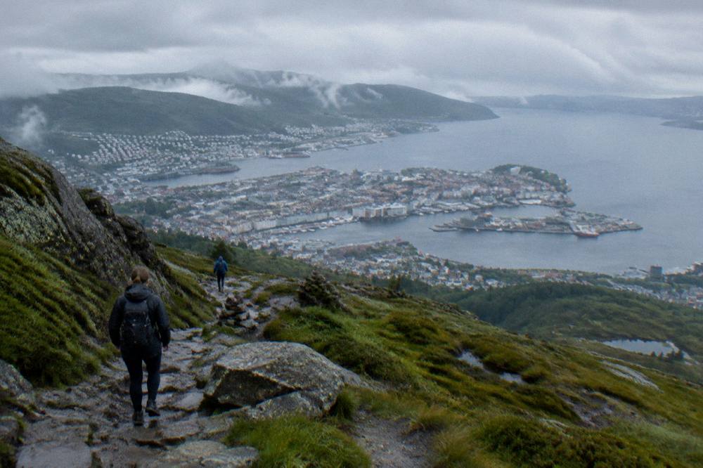
Hiking in Bergen is safe for prepared walkers, but the climate sets the terms: the trailing 13 months recorded 217 days with precipitation at the city station, fog can swallow a plateau in minutes even in summer, and the trails are stone, root and gravel rather than engineered paths, so the safety margin comes from clothing, a charged phone and a willingness to turn around, not from the terrain itself.
The specific risks are boring, which is why they get ignored. Wet stone steps are slick on descent, especially the polished sections of Stoltzekleiven. Fog on the plateaus flattens visibility to a few metres and pulls a viewpoint walk into a navigation exercise. And the mild coastal winter means ice arrives without warning on shaded paths some mornings while the harbour below stays above freezing. None of this is dangerous to a walker in proper shoes with a rain layer; all of it is dangerous to a walker in city trainers at 4pm in November.
The numbers make the preparation case better than adjectives do.
| Verified condition, Bergen station | Figure |
|---|---|
| Days with precipitation, trailing 13 months | 217 |
| Highest temperature recorded in the period | 28.0C, on 14 August |
| Lowest temperature recorded in the period | -11.3C, on 8 January |
| Wettest observed month | November, 321.8 mm |
| Driest observed month | January, 82.0 mm |
Weather data and what it means for shoes, layers and umbrellas, or rather for why umbrellas lose to hoods in this city, is covered properly in the Bergen weather guide. The short version for trail use: a real rain jacket over insulating layers, shoes with grip, and no assumption that the morning's sky holds.
What Lies Beyond The City Trails?
Beyond the mountains that ring the city, Bergen's hiking expands into fjord-country day trips, from the waterfalls and ferry crossings of the Hardangerfjord region to the longer fjord and railway combinations further north, and these are full-day outings with transport included rather than half-day city walks, so they reward a different kind of planning and, in several cases, a booked seat.
The fjord tours from Bergen guide is the full directory of what sits within day-trip range, and the distinction that matters for hikers is between tours that stop at viewpoints and tours that put you on ground you walk. The Hardangerfjord region, with its waterfalls and its ferry crossings, is the classic walking-adjacent day out, pairing dramatic stops with a guide who handles the driving; a guided Hardangerfjord tour with waterfalls and a ferry crossing is the bookable form of that day.
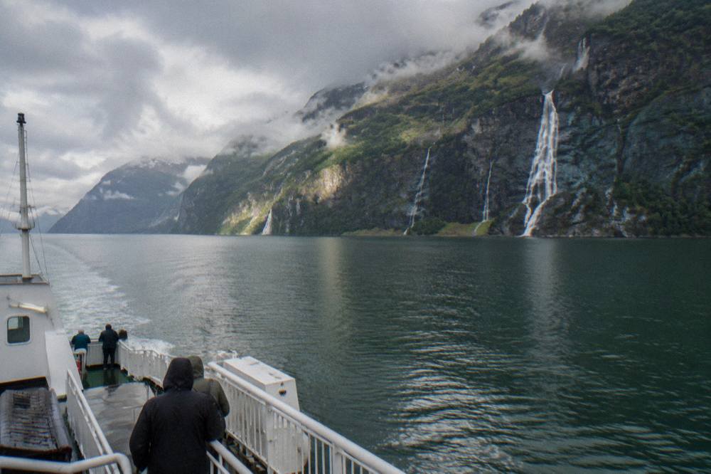
For a different angle on the same landscape, the water itself is walkable-adjacent: a guided kayak outing puts you at fjord level rather than summit level, and Guided Kayak Tour Bergen runs from the harbour side of the city.
The pattern worth noticing across all of these: the city climbs are free and spontaneous, while the beyond-the-city days run on schedules, ferries and, in the busiest summer weeks, seats that sell out. The fjord tours from Bergen page sorts which is which.
What Should You Wear On A Hike In Bergen?
Wear for rain first and warmth second: a waterproof shell with a hood, insulating layers you can add and remove on the climb, and shoes with real grip for wet stone and roots, because the Bergen station's trailing-year data shows 217 days with precipitation and mean temperatures that ranged from -1.4C in January to 14.9C in July, so the clothing system that works is the one built around staying dry.
The layering logic is simple. The climb up Stoltzekleiven is warm work even on a cool day, the plateau at the top is often ten wind-chilled minutes later a completely different thermal proposition, and the descent is static enough that sweat gone cold becomes the problem. A base layer, a mid layer and a shell, adjusted at the top rather than suffered through, beats any single thick jacket. Trousers that dry matter more than trousers that are warm; wet denim stays wet for hours, which is a general Norway packing point and a specific Bergen hiking one.
Footwear is the honest dividing line. City trainers are fine for the funicular and the Fløyen viewpoint loops. They are not fine for the Stoltzekleiven stairs in rain, and they are a bad idea on the Ulriken ridge paths. Broken-in trail shoes with grip are the single piece of gear that most improves a Bergen hiking day. For everything else in the suitcase, the planning a trip to Bergen page is the practical companion.
Where Do You Eat After A Hike In Bergen?
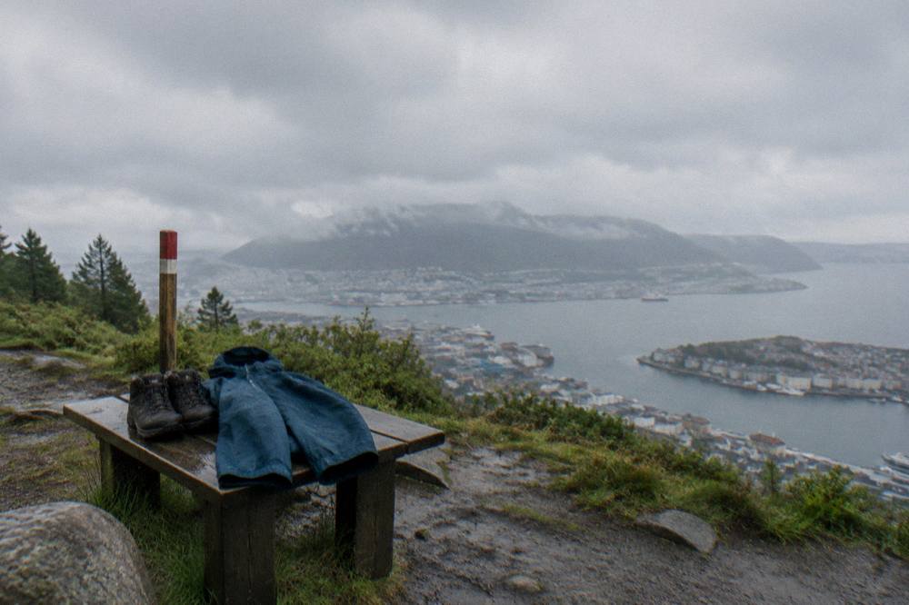
The honest post-hike eating answer in Bergen is the harbour and the streets immediately behind it: the Fish Market sits at sea level between the Fløyen funicular's lower station and the Sandviken end of the Stoltzekleiven approach, and the restaurants within a short walk of that square are where the city's walk-weary feet converge, with the full directory in the best restaurants in Bergen guide.
The geography flatters hungry walkers. Descending Fløyen by funicular puts you minutes from the harbour-side food; finishing the stairs and walking back toward the centre passes through Sandviken's wooden-house streets and toward the same cluster. Bergen's food identity leans on seafood from the surrounding cold water, and after a mountain the portion sizes tend to be received well.
For walkers who want the food story told rather than found, a Taste of Bergen food tour with the Fløyen funicular combines the eating with the ride up, which makes it the natural rest-day bookend to a hiking itinerary. And for the full restaurant directory, price tiers and neighbourhoods, the best restaurants in Bergen guide is the site's dedicated page.
Whichever order you choose, the pattern holds: climb in the morning, eat at sea level, and let the city's rain schedule decide the rest.
Common Questions About Hiking In Bergen
What is the most popular hike in Bergen?
The Stoltzekleiven stone stair climb from Sandviken to the Fløyen plateau. It is free to walk, starts inside the city, and ends on the mountain every visitor knows from the funicular.
Is Stoltzekleiven free?
Yes, the stair climb itself is a public trail and costs nothing. The Fløyen funicular you might ride down is a separate paid service, with return pricing published in the official 2026 Bergen Card flyer.
Do I need the Bergen Card for hiking?
No hike requires it, but the card covers Skyss buses and the Bybanen light rail across Vestland county, which reaches the trailheads. A 24-hour card costs 400 NOK for an adult per the official 2026 flyer.
Can children do the Bergen mountain hikes?
The Fløyen plateau paths are the family-friendly option, being flat gravel and forest loops near the top station. Stoltzekleiven is a steep stair climb better suited to older children with steady legs.
Is the Ulriken cable car open all year?
It runs year-round apart from scheduled maintenance, which closes it in the first two weeks of 2026 with a reopening around 13 January, plus standard Christmas closures, per ulriken643.no.
What shoes should I wear hiking in Bergen?
Trail shoes or boots with grip. The station data shows 217 days with precipitation over the trailing 13 months, and wet stone stairs and roots are the norm rather than the exception.