Is Bergen A Walkable City?
Bergen in Vestland, Norway is compact, steep and best explored on foot. A plain answer on what you can walk to, where the hills bite, and when you need transport.
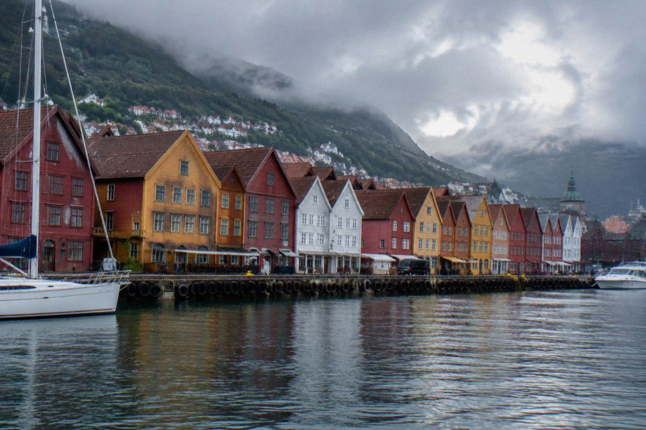
Bergen, in Vestland county on Norway's southwestern coast, was built on foot and it still works on foot. Its Hanseatic wharf, Bryggen, was inscribed on the UNESCO World Heritage List in 1979, and the whole historic trading core sits within a basin of tightly packed streets between the harbour and the mountains of Fløyen. The kommune counts 294,860 residents, yet the part a visitor actually needs is small. yr.no's Bergen station table shows the weather you will be walking in: 217 days with precipitation over the trailing 13 months, which is why every local owns good boots and a hood.
Is Bergen A Walkable City?
Yes, Bergen is a genuinely walkable city, and walking is the normal way to see it. The historic centre, the Bryggen wharf, the fish market, the harbour and the main museums all sit inside a compact bowl between the waterfront and the mountains, connected by lanes and stairs rather than dual carriageways. The catch is vertical: Fløyen rises directly behind the town, so some walks involve serious climbing, and the rain, 217 days with it in the trailing 13 months, means waterproofs are not optional.
Practically nobody drives in central Bergen, and few visitors need to. The streets of the old town, from Torgallmenningen through the Sandviken quarter to the tip of Nordnes, are the attraction themselves. Narrow wooden houses, covered walkways that shelter you from drizzle, sudden staircases between street levels: this is a city whose texture rewards a slow pace and punishes a schedule. A sensible first move is a guided walk, and the food and culture walk is a strong one because it sets the geography straight while you eat, with a local guide leading the way. Check availability
How Compact Is Bergen's Centre On Foot?
Bergen's core is small enough that visitors can manage day-to-day sightseeing without opening a transit app. The harbour, the fish market, Bryggen, the cathedral, the KODE art museums, the fortress of Bergenhus and the aquarium all cluster within one continuous walkable zone, and the two funicular-served mountains frame that zone rather than sit outside it. The compactness is a legacy of the medieval and Hanseatic street plan, which no later road scheme ever managed to bulldoze.
The city grew around its harbour, and that history decided its shape. Everything commercial sat close to the water because everything arrived by boat, so the warehouses, the counting houses and the churches crowded into a strip no wider than the bowl allowed. Later neighbourhoods climbed the hillsides, which is why the flat centre stays flat and the views stay close. The bergen-card flyer shows how dense the sightseeing is: dozens of named attractions with individual NOK entry prices, nearly all of them listed on a single fold-out page because nearly all of them are a short stroll apart.
| Area | Character | Why it works on foot |
|---|---|---|
| Vågen harbour and Bryggen | Hanseatic wharf, wooden gables, small shops | Flat quayside, lanes closed to through traffic |
| Torgallmenningen and Marken | Main square and pedestrianised shopping streets | Car-free spine linking station to harbour |
| Nordnes | Peninsula with the aquarium and old wooden houses | Flat shore walk around the point |
| Sandviken | White clapboard houses on steep lanes north of the wharf | Pretty but stair-heavy, take it slowly |
| Fjellsiden | The hillside belt below Fløyen | Streets turn into steps and climbs |
For planning, the honest summary is that the flat core is effortless, the hillside quarters are hard work, and the rewards scale with the effort. If you are weighing two days against four, the walkability is a point in favour of staying longer, since three days in Bergen is roughly where you stop needing to rush.
Where Does Walking In Bergen Get Steep?
The steep parts of Bergen are the famous ones: the climb to Fløyen via the Stoltzekleiven stone staircase, the hillside lanes of Sandviken, and the slopes below Mount Ulriken. Bergen's centre is flat, but the city is built in a bowl, and every direction that leaves the harbour goes up. The standard advice from every local source is to walk up and ride down, or ride both ways, because the funicular and the cable car exist precisely because these slopes were never practical for wheeled transport.
The Stoltzekleiven staircase is the city's signature climb, a stone step path straight up the mountainside that locals use as training. It is genuinely strenuous, and in wet weather the stones are slick. The gentler alternative, or the reward after the climb, is the Fløibanen funicular, whose return fare the Bergen Card flyer lists at 200 NOK for an adult from 1 April to 30 September and 145 NOK from 1 October to 31 March. On the other side of the bowl, the Ulriken643 cable car charges 435 NOK for an adult return, confirmed on ulriken643.no's own price page, and takes you to the highest of the seven mountains. Whether the views justify each fare is argued in detail on the funicular versus cable car comparison, and the case for the funicular in particular is laid out in is the Bergen funicular worth it.
Does Bergen's Rain Ruin Walking?
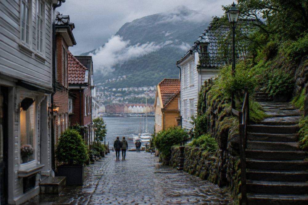
No, rain in Bergen is a nuisance to dress for, not a reason to stop walking. The yr.no Bergen station table shows the trailing 13 months brought 217 days with precipitation, monthly averages from -1.4C in January 2026 to 14.9C in July 2026, so the climate is temperate, oceanic and reliably damp. Walkable does not mean dry here, and the city's lanes, arcades and indoor museums exist partly because its residents have always walked in this weather anyway.
The honest monthly picture is uneven, and it is worth reading the actual numbers rather than repeating the city's rainy reputation. April 2026 brought only 65.9 mm of rain while November 2025 delivered 321.8 mm, and the temperature never sits at either extreme for long. What this means for a walker is simple: layers, a real waterproof shell, and shoes with grip. Locals do not carry umbrellas much, because the wind off the fjords destroys them, they wear hoods. The wider set of guides lives on Bergen Travel Guide.
| Month (yr.no Bergen station data) | Mean temperature | Precipitation |
|---|---|---|
| January 2026 | -1.4C | 82.0 mm |
| April 2026 | 7.9C | 65.9 mm |
| July 2026 | 14.9C | 184.2 mm |
| October 2025 | 9.7C | 231.9 mm |
| November 2025 | 6.0C | 321.8 mm |
The rain also shapes where you walk. Bryggen's wooden buildings lean over covered passages, the KODE museums sit a few minutes from the harbour, and the fish market sits in the middle of everything, so a wet afternoon reroutes itself without much planning. The city has effectively pre-solved the bad-weather itinerary, which is one reason a rainy day in Bergen is a guide worth writing rather than an apology.
Do You Need A Car Or Public Transport In Bergen?
You do not need a car in Bergen, and hiring one actively works against you because central parking is scarce and the hills defeat short cuts. Public transport exists for exactly three visitor jobs: the light rail from the airport, the buses out to suburbs and trailheads, and the Bergen Card, which bundles free Skyss buses and Bybanen travel county-wide. A single zone A Skyss ticket costs 51 NOK according to the transport listing on visitbergen.com.
For a walkable city, Bergen still has excellent bones underneath. The Bybanen light rail and the Skyss buses cover what legs cannot, and the Bergen Card's own flyer is explicit that a card holder rides them free across Vestland county, the airport line included. That matters for the days when you want to walk somewhere other than the centre, or when the rain finally wins an argument. The full case for skipping a rental, including the parking situation, is covered in the getting around Bergen guide, and the airport-to-centre options are laid out in the Bergen airport guide.
What you should not do is treat transport as a sightseeing tool inside the centre. The distances are short, the lanes are interesting, and a bus window hides exactly the detail that makes the city worth the trip. Walk the core, ride the funicular up, ride the light rail in from the airport, and spend the money you saved on not renting a car on dinner instead, where the what food is Bergen famous for rundown starts a very reasonable conversation.
Which Bergen Neighbourhoods Are Best Explored Walking?
The best walking in Bergen is in the flat Hanseatic core around Vågen, the wooden-house lanes of Sandviken and Nordnes, and the stepped hillside streets that climb toward Fløyen. Each of these areas delivers something the others do not: the wharf gives history, Nordnes gives sea air and the aquarium, Sandviken gives the postcard white clapboard, and the hillside gives views and staircases. None of them rewards arriving by vehicle.
Marken and Skostredet are the interior shopping streets, mostly pedestrianised, threading from the main square toward the harbour. Sandviken, just north of Bryggen, is where the guidebooks send photographers, white wooden houses stacked on slopes with cobbled lanes between them, and it is steep enough that you should treat it as a walk rather than a route. Nordnes, the peninsula across the harbour mouth, is the flattest and calmest of the three, with the aquarium at the end of the point and the old baths of Nordnes Sjøbad along the shore. For a sense of how these areas string together on a first visit, the one day in Bergen itinerary does the whole loop on foot.
The general rule across all of them: the more the street looks like a staircase, the better the view, and the wetter the stone. Bergen rewards people who look at a hill and walk up it anyway, then takes the funicular down. That trade, effort on the way out, comfort on the way back, is the city's whole personality compressed into one decision.
Common Questions About Walking In Bergen
Is bergen a walkable city?
Yes. Bergen's historic centre is compact and mostly flat, its main sights cluster between the harbour and the mountains, and its lanes and stairs are themselves the attraction. The only qualifications are the steep hillsides and the frequent rain, both of which are manageable with the right shoes and a waterproof layer.
Can you walk everywhere in Bergen without a car?
Yes for the city centre, the harbour, the museums and both mountain bases. A car helps only for regional day trips into the fjords, and even those are usually better done by fjord tour, train or bus. Inside the centre, a car is closer to a liability than a help.
How steep is the walk up to Fløyen?
Steep. The Stoltzekleiven staircase climbs the mountainside in stone steps and is used by locals as fitness training, so it is a genuine workout in dry weather and a slick one in rain. The Fløibanen funicular exists as the alternative, and most people either ride up and walk down or walk up and ride down.
Is Bergen safe to walk around at night?
Central Bergen is a small, busy city core with a late-night restaurant and bar scene around Torgallmenningen and the harbour, and walking there in the evening is normal practice. As anywhere, keep the usual grip on your belongings, and take lit main streets over empty hillside lanes, which are dark and steep.
What should I wear for walking in Bergen?
Waterproof shoes with real grip, a hooded waterproof rather than an umbrella, and layers you can shed on a climb. The yr.no station data shows precipitation on 217 of the trailing 13 months' days, and the stone lanes and staircases hold water long after the rain stops. Pack for damp, not for arctic cold.
Bergen is a city that answers its own question. It was built for legs, not wheels, and every year a few million visitors confirm the design still works. Bring the boots, respect the hills, and let the rain decide the lunch stop.